

WildTrack: tu copiloto inteligente off-road
Analiza barro, terreno y riesgo en cada tramo de tu ruta off-road.
Alertas de zonas peligrosas, pistas cortadas y puertas cerradas. Para trail, enduro y 4x4 en España.
Everything you need for a proper day on the trails
Practical tech built into our off-road routes app: community intelligence, mud and terrain analysis, offline maps and the tools you actually use out on the lanes.
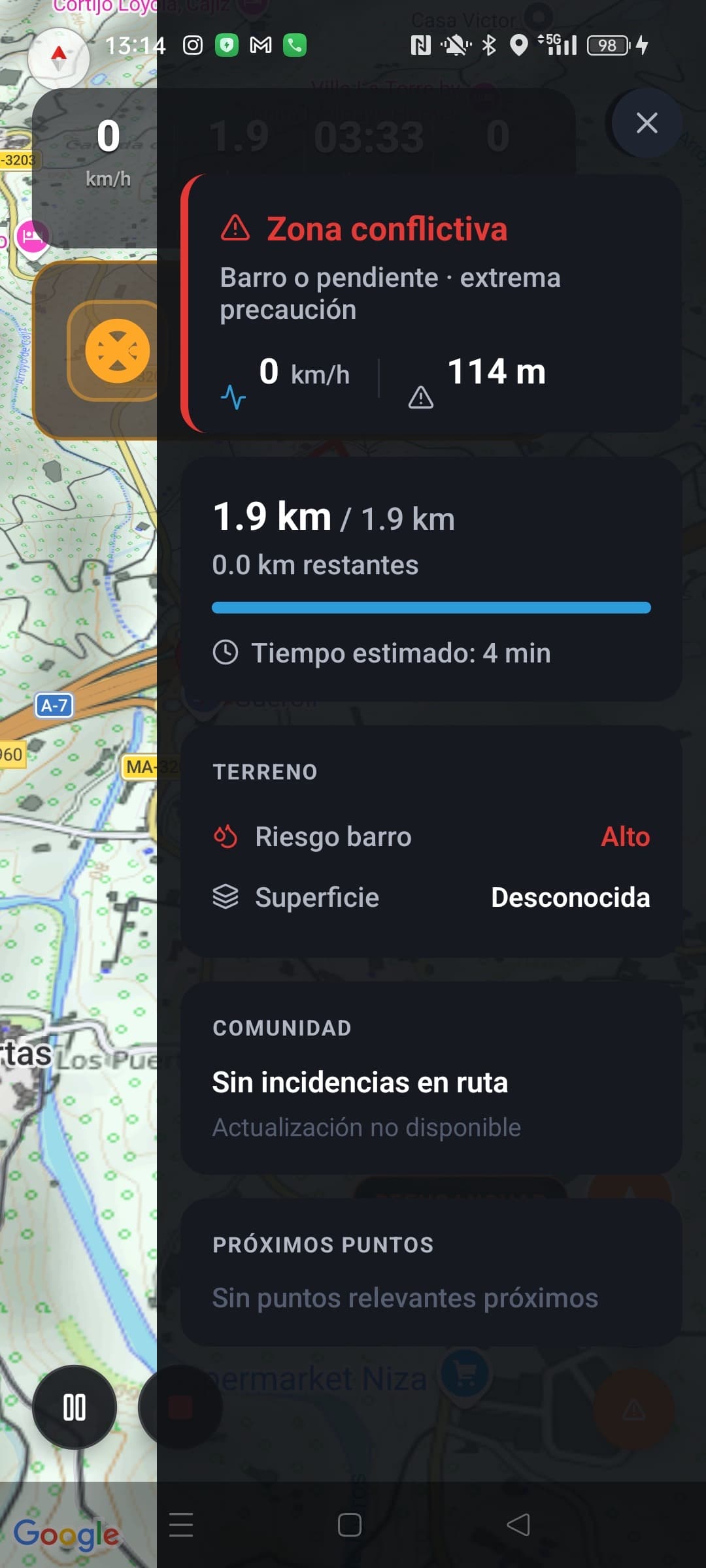
Mud Risk Engine
Mud prediction from 24h/48h rainfall, humidity, temperature and rider reports, scored on every 150 m of track. More info
Community AI
AI reads comments and reports to keep the risk level of each zone up to date automatically.
Track Segmentation
Every track is split into 150 m segments with terrain, elevation, weather and an estimated risk score.
Smart Navigation
Steady GPS tracking that stops trying to send you back onto tarmac.
Track Recording
Record your ride with a single tap and export the GPX automatically.
AI Optimisation
AI tidies up your tracks — spotting drift, GPS jumps and dodgy fixes. Find out more
Rally Intelligence™
Safety alerts pulled straight from the roadbook. The system flags risk zones and warns the rider before they arrive. More info
Start planning your next day out on the lanes
Create a free account and start planning off-road routes with real terrain data behind them.
Create free accountThe community's most popular tracks
A live ranking: the routes most viewed and downloaded by trail, enduro and 4x4 riders. Recalculated every night.
Estamos preparando las primeras rutas verificadas.
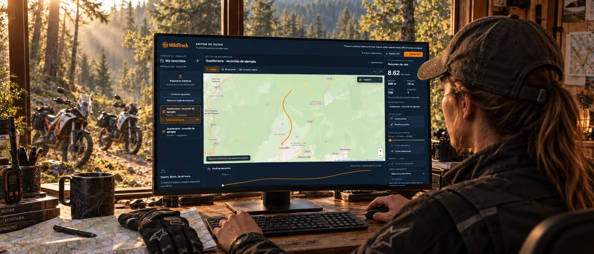
Free GPX editor in your browser
Edit, trim and simplify GPX tracks before heading out, without installing anything and without signing up to edit. Move points one by one, split or merge sections, reverse the direction and watch the elevation profile update live. When you're ready, export a standard GPX for your Garmin or send it to the WildTrack app to navigate it offline.
- Import, edit and export GPX for free
- No install, no account required to edit
- Live elevation profile
- Send to the app for offline navigation
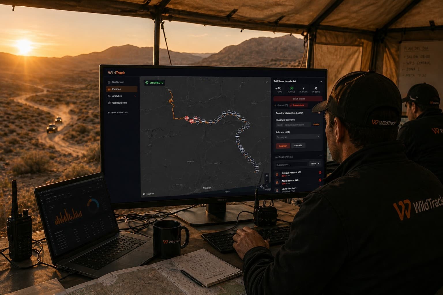
Do you organise off-road events?
Run your rally, raid or trail meet with the same tools clubs and organisers already use: digital roadbook for the riders, live control centre with real-time tracking, stages and categories, entries with Excel import, and publishing on WildTrack to reach riders across the country.
Digital roadbook
Deliver the roadbook to participants in the app with GPS auto-scroll and offline maps.
Live control centre
Follow each rider on the map, resolve SOS and send critical alerts without switching screens.
Stages, categories and entries
Organise by days, categories and race numbers. Import participants from Excel.
Visibility on WildTrack
Publish the event to the trail, enduro and 4x4 community.
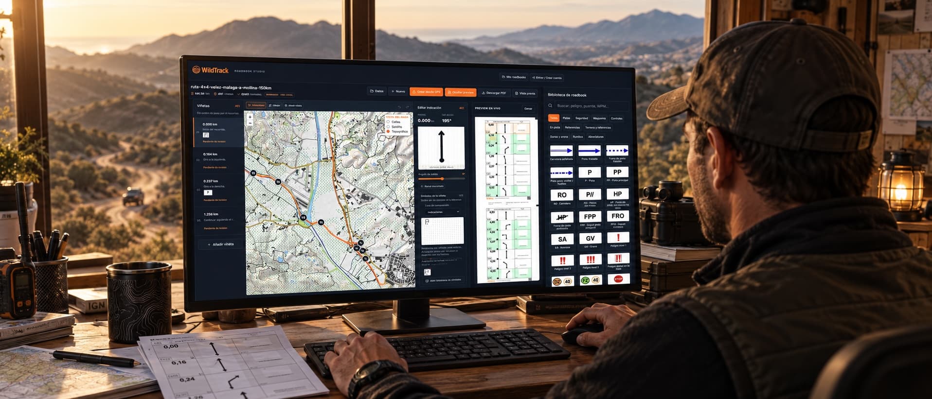
Turn a GPX into a roadbook
Import a GPX and the editor spots the turns, generates a draft of tulips with distances and headings. Tweak the tulips, drag FIM symbols in, export a clean A4 PDF ready for the roadbook holder, and scan the QR in the footer to open it in the app and ride it with Rally Cockpit.
- Automatic tulips from your GPX
- FIM and WildTrack symbol libraries: 286 icons
- A4 PDF with QR to open in the app
- Start free, no install required
Common questions about WildTrack
How is WildTrack different from a normal sat nav?
WildTrack won't try to reroute you back onto tarmac or hunt for the fastest way through. It analyses mud, terrain, gradient and weather to show the risk on every section — which matters when you need to stay on legal green lanes and BOATs rather than drifting onto a bridleway. See how it works on the app page.
Does WildTrack work without signal?
Yes. With WildTrack Pro you can download full topographic maps and navigate off-road with no signal at all — useful when you're following a byway across open moorland and the phone drops out. Check our off-road guides for setting the maps up.
Is WildTrack only for trail bikes, or also for 4x4?
WildTrack is built for trail bikes, enduro, 4x4 and overlanding alike. Have a read of the rider stories for real examples.
How does WildTrack calculate mud risk?
The Mud Risk Engine combines 24/48h rainfall, humidity, temperature, gradient, surface type and reports from the off-road community.
What does a route's compatibility percentage actually mean?
It's an estimate based on distance, technical difficulty and the risk tolerance you've set. Have a look through all available tracks to find ones that suit you.
WildTrack Pro: proper off-road intelligence for real riders
AI Copilot, Terrain Intelligence, offline maps and predictive alerts. Everything you need to handle any green lane or off-road route.
AI Copilot
A copilot that understands your route, the terrain and the conditions. Ask it anything you need while you're out on the lane.
Terrain Intelligence
Mud prediction, weather alerts and community reports on the actual state of the ground.
Offline Maps
Take your routes with you, even where the signal drops out completely.
Predictive Alerts
The system learns from the terrain and warns you before you ride into a problem.
Explore everything WildTrack offers
Off-Road Routes App
Smart navigation for trail, enduro and 4x4
Off-Road Community
Share routes and connect with off-road riders
Off-Road Stories
Real chronicles of riders on routes
Off-Road Guides
GPS, GPX and off-road navigation tutorials
Offroad GPS
Internet-free navigation for trail, enduro and 4x4
Download GPX
GPX tracks for 4x4, trail and enduro
Convoy and SOS without coverage
Experimental technology to share position and send SOS in areas without mobile coverage.
ExperimentalOffline Maps
Download maps and navigate even on routes without connection.
Roadbook Rally Pro
Advanced digital roadbooks for events, raids and rally navigation.
Checkpoint adventure
4x4 gymkhanas and waypoint rallies for clubs and organizers.
GPX editor online
Edit, trim and simplify GPX tracks for free in your browser.
Roadbook Studio
Build roadbooks with tulips and export a PDF ready to ride.
For organisers
Digital roadbook, control centre and off-road event management.